"The conference had the best scientific substance I have seen yet," said Dr. Mostafa, adding, "I enjoyed detailed research presentations by the most dedicated professionals in geomatics. LiDAR was an especially prevalent topic."
Mostafa presented his paper, Accuracy Assessment of Professional Grade Unmanned Systems For High Precision Airborne Mapping.
Here is a summary:
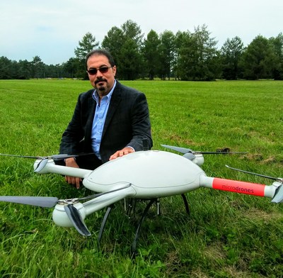
- The study consisted of eight flights flown using Microdrones mdMapper1000DG UAV mapping package, equipped with a Sony RX1RII and Sony αR7 integrated with Trimble APX-15.
- The resulting accuracies matched the traditional well engineered manned systems.
- The paper presented the results of a geometric accuracy assessment project for unmanned systems equipped with multi-sensor systems for direct georeferencing purposes.
- The paper identified a number of parameters that either individually or collectively affect the quality and accuracy of a final airborne mapping product.
- Assessment of the final ground object positioning accuracy was presented through eight real-world flight missions.
- The achievable precision of map production was addressed in some detail.
Click here to read the complete paper.
The Microdrones team was honored to have their products and work included in the body of geomatics being presented at this event. "This was a great learning and networking opportunity and we look forward to the next conference in the Netherlands in 2019," concluded Mostafa.
To learn more about the Microdrones mdMapper1000DG system used in this study, visit: https://www.microdrones.com/en/mdsolutions/mdmapper1000dg/

View original content with multimedia: http://www.prnewswire.com/news-releases/dr-mohamed-mostafa-presents-at-unmanned-aerial-vehicles-in-geomatics-conference-300522930.html
SOURCE Microdrones
| Contact: |
| Microdrones
Unmanned Aerial Vehicles in Geomatics Conference Mike Dziok, Marketing Director Email Contact Web: http://www.microdrones.com |


